Google Earth can be too much of a good thing
By Roopinder Singh
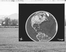
Imagine having the earth at your fingertips. With Google Earth, it has come true for millions of people who have access to computers and broadband Internet connections. They can, with the flick of their mouse and a tap on their keyboard, zoom into any corner of the earth and see it-literally.
Sensitive information should not become freely available for misuse
Google Earth combines satellite imagery, aerial photography and data from maps to make a 3D interactive template, or a virtual globe. As with some other Google applications, Google Earth was not the pioneer. Actually, Google was a latecomer; it bought a company called Keyhole Inc, which had created a programme called Earth Viewer, tweaked it and re-named it Google Earth, which delivers a great experience to computer users, who came to sample the latest in global voyeurism.
Indeed, it has turned some computer users into Peeping Toms. The resolution of images that you get from Google Earth’s new ‘Street View’, service, that provides users a street-level picture of downtown areas of various U.S. cities, is so good that you can even read number plates and identify people! This is clearly a case of too much of a good thing.
The American Civil Liberties Union of Northern California recently took issue with Google’s new Street View feature. The service would allow someone to identify people entering and exiting doctor’s offices, and could, thus, seriously impact public anonymity. As the ACLU put it, this feature raises “privacy concerns for individuals who are unwittingly captured by Google’s candid cameras.”
Google has long been facing charges about providing information that impacts the security of nations, and, indeed, international security, since it provides information that can be used by terrorists.
A month or so ago, police in the US foiled a plan by a terrorist cell to blow up fuel tanks and a jet fuel pipeline at New York’s John F. Kennedy International Airport. Evidently, Google-produced images that clearly showed the airport’s infrastructure were used for planning.
President A.P.J. Abdul Kalam had expressed concern over the availability of high-resolution pictures of sensitive locations in India, as had the Indian Space Research Organisation, when it became clear that vital installations, including IAF airports and sensitive buildings like nuclear plants, were clearly showing on Google Earth. Security agencies had demanded that Google remove the images, or at least blur them. Google did agree to the request.
What is the resolution of images that Google Earth provides? Well, it is about 15 m per pixel for most land areas. It could be double that for some densely populated areas, and lower for oceans. Only some cities in the US and in Europe are mapped with a very high resolution.
How does Google Earth operate? It maps the earth by the superimposing images obtained from satellite imagery, aerial photography and GIS 3D globe. It actually uses much of the commercially or freely available images from various government agencies, particularly NASA’s globe software World Wind using Blue Marble, Landsat or USGS layer, each of which is a terrain layer in the public domain.
Google Earth is one of the many players in this game and other include such Internet giants as Yahoo, with its Yahoo Maps; Amazon.com Inc.’s A9.com already has showed street-level views of two dozen major American cities through its BlockView mapping service, and Microsoft Live Search Maps service that plans to expand to include more cities worldwide.
‘Eye in the sky’ has been an uncomfortable reality for over five decades now, but it was largely in the domain of security agencies, which operated under government-determined norms. Now that the images and maps of the globe are freely available, companies that provide these services will have to show restraint to ensure that sensitive information does not become freely available for misuse by terrorists.
This article was published in The Tribune on Friday, June 15, 2007